.svg "edstellar")

Corporate Spatial Analysis and Satellite Imagery in a GIS Training Course
Edstellar's instructor-led Spatial Analysis and Satellite Imagery in a GIS training course equips teams with geographic data skills for informed decision-making. The training enables teams to master interpreting satellite imagery techniques and integrating geospatial data. Elevate your team's proficiency to optimize processes in various fields.

(Virtual / On-site / Off-site)
Drive Team Excellence with Spatial Analysis and Satellite Imagery in a GIS Corporate Training
Empower your teams with expert-led on-site/in-house or virtual/online Spatial Analysis and Satellite Imagery in a GIS Training through Edstellar, a premier Spatial Analysis and Satellite Imagery in a GIS training company for organizations globally. Our customized training program equips your employees with the skills, knowledge, and cutting-edge tools needed for success. Designed to meet your specific training needs, this Spatial Analysis and Satellite Imagery in a GIS group training program ensures your team is primed to drive your business goals. Transform your workforce into a beacon of productivity and efficiency.
Spatial Analysis and Satellite Imagery in a GIS involve using geographic information systems to analyze spatial patterns and interpret satellite imagery for informed decision-making. The Spatial Analysis and Satellite Imagery in a GIS training course equips employees with valuable insights into spatial patterns, relationships, and trends, enabling them to make informed judgments regarding resource management, urban planning, environmental monitoring, and disaster response.
Edstellar's instructor-led Spatial Analysis and Satellite Imagery in a GIS training course offers a unique blend of theoretical knowledge and practical application, delivered through virtual/onsite sessions by industry experts with years of experience in the domain. The course is highlighted by its expert practical exercises and a customizable curriculum tailored to meet your organization's specific needs.
Key Skills Employees Gain from Spatial Analysis and Satellite Imagery in a GIS Training
Spatial Analysis and Satellite Imagery in a GIS skills corporate training will enable teams to effectively apply their learnings at work.
- Spatial Data AnalysisSpatial Data Analysis involves interpreting geographic data to identify patterns and relationships. This skill is important for urban planners, geographers, and data scientists to make informed decisions.
- GIS Software ProficiencyGIS Software Proficiency is the ability to use geographic information systems for mapping and analyzing spatial data. This skill is important for roles in urban planning, environmental science, and logistics, as it enables informed decision-making and efficient resource management.
- Remote Sensing InterpretationRemote Sensing Interpretation is the ability to analyze satellite or aerial imagery to extract meaningful information. This skill is important for roles in environmental monitoring, urban planning, and disaster management, enabling informed decision-making.
- Spatial Problem-SolvingSpatial Problem-Solving is the ability to visualize and manipulate objects in space. this skill is important for roles in engineering, architecture, and design, as it enhances creativity and efficiency in project execution.
- Raster and Vector Data ManipulationRaster And Vector Data Manipulation involves editing and analyzing spatial data formats. This skill is important for GIS analysts and cartographers to create accurate maps and insights.
- Data IntegrationData Integration is the process of combining data from different sources into a unified view. this skill is important for roles like data analysts and engineers, as it enables informed decision-making and enhances data accuracy.
Key Learning Outcomes of Spatial Analysis and Satellite Imagery in a GIS Training Workshop for Employees
Edstellar’s Spatial Analysis and Satellite Imagery in a GIS training for employees will not only help your teams to acquire fundamental skills but also attain invaluable learning outcomes, enhancing their proficiency and enabling application of knowledge in a professional environment. By completing our Spatial Analysis and Satellite Imagery in a GIS workshop, teams will to master essential Spatial Analysis and Satellite Imagery in a GIS and also focus on introducing key concepts and principles related to Spatial Analysis and Satellite Imagery in a GIS at work.
Employees who complete Spatial Analysis and Satellite Imagery in a GIS training will be able to:
- Apply raster analysis techniques to delineate zones and regions within spatial datasets, enabling employees to identify and analyze spatial patterns relevant to their field of work
- Utilize raster masking and NoData cell handling methods to preprocess data effectively, ensuring the accuracy and reliability of raster analysis results in real-world applications
- Implement local raster operators to perform precise spatial analysis tasks at the individual cell level, facilitating detailed examination of spatial relationships and patterns within raster datasets
- Utilize raster boolean overlay operations to combine multiple raster datasets efficiently, enabling employees to perform complex spatial analyses such as suitability assessments and land use planning
- Employ raster reclassification techniques to categorize and organize raster data based on specific criteria, facilitating decision-making processes and spatial modeling in diverse professional domains
Key Benefits of the Spatial Analysis and Satellite Imagery in a GIS Group Training
Attending our Spatial Analysis and Satellite Imagery in a GIS classes tailored for corporations offers numerous advantages. Through our Spatial Analysis and Satellite Imagery in a GIS group training classes, participants will gain confidence and comprehensive insights, enhance their skills, and gain a deeper understanding of Spatial Analysis and Satellite Imagery in a GIS.
- Learn advanced techniques in raster analysis, empowering employees to unlock the full potential of spatial data for informed decision-making
- Equip yourself with practical skills to effectively manipulate raster datasets, enabling streamlined data preprocessing and analysis workflows
- Develop proficiency in utilizing GIS tools for raster analysis, enhancing your ability to solve complex spatial problems in various professional domains
- Explore real-world applications of raster analysis, gaining insights into environmental monitoring, land management, urban planning, and other critical areas
- Learn to interpret and visualize raster data effectively, allowing for comprehensive spatial analysis and meaningful interpretation of geospatial information
Topics and Outline of Spatial Analysis and Satellite Imagery in a GIS Training
Our virtual and on-premise Spatial Analysis and Satellite Imagery in a GIS training curriculum is divided into multiple modules designed by industry experts. This Spatial Analysis and Satellite Imagery in a GIS training for organizations provides an interactive learning experience focused on the dynamic demands of the field, making it relevant and practical.
- Interactive selection in ArcMap
- Utilizing ArcMap's interactive selection tools for data manipulation
- Exploring the functionality of interactive selection for efficient data filtering
- Select by attribute
- Understanding the process of selecting features based on attribute values
- Applying attribute queries to filter data subsets
- Queries and Venn diagrams
- Using Venn diagrams to visualize the results of queries
- Understanding the logic behind combining multiple queries
- Select by location
- Performing spatial queries to select features based on their spatial relationships
- Exploring different spatial selection methods such as intersecting and contain
- Select by attribute and location in ArcMap
- Integrating attribute and spatial queries for comprehensive data selection
- Applying combined queries to extract relevant subsets of data
- Mixing attribute and location queries
- Exploring advanced query operations involving attribute and spatial criteria
- Understanding the nuances of mixing attribute and location queries for complex data analysis
- Vector buffers
- Understanding the creation and application of vector buffers
- Exploring buffer analysis for proximity-based spatial operations
- Raster distances
- Analyzing distance calculations in raster datasets
- Understanding the significance of raster distances in spatial analysis
- Ian McHarg
- Exploring the contributions and methodologies of Ian McHarg in environmental planning
- Understanding the application of McHarg's principles in GIS analysis
- Vector intersection and union
- Understanding vector overlay operations for spatial analysis
- Exploring techniques for vector intersection and union to analyze spatial relationships
- Constraint analysis
- Applying constraint analysis for spatial planning and decision-making
- Understanding how constraint analysis helps identify suitable locations for various purposes
- Areal interpolation
- Exploring techniques for estimating values within polygons
- Understanding the applications of areal interpolation in spatial analysis
- Spatial join
- Understanding the process of combining attribute data from different layers based on spatial relationships
- Exploring the applications of spatial join for data integration and analysi
- What is geoprocessing?
- Understanding the concept of geoprocessing and its role in spatial analysis
- Exploring various geoprocessing operations and their applications
- Getting started with ModelBuilder
- Introduction to ModelBuilder, a visual programming environment in ArcGIS
- Learning the basics of creating, editing, and executing geoprocessing models
- What is remote sensing?
- Understanding the fundamental concept of remote sensing and its applications in GIS
- Exploring the various platforms and technologies used in remote sensing data acquisition
- Spatial resolution of satellite images
- Defining spatial resolution and its significance in satellite imagery
- Exploring the factors affecting spatial resolution and its impact on image interpretation
- Temporal resolution of satellite sensors
- Defining temporal resolution and its importance in capturing changes over time
- Exploring the capabilities and limitations of satellite sensors in terms of temporal resolution
- Radiometric resolution of satellite sensors
- Understanding radiometric resolution and its role in capturing the intensity of electromagnetic radiation
- Exploring methods for calibrating and enhancing radiometric resolution in satellite imagery
- Spectral resolution of satellite sensors
- Defining spectral resolution and its ability to differentiate wavelengths of electromagnetic radiation
- Exploring the spectral characteristics of different satellite sensors and their applications
- Spatial vs. spectral resolution
- Comparing and contrasting spatial and spectral resolutions in remote sensing
- Understanding their respective advantages and limitations in different applications
- Spectral signatures of land cover types
- Exploring the concept of spectral signatures and their significance in land cover classification
- Understanding how spectral signatures are used to differentiate between different land cover types
- Displaying multiband satellite images
- Exploring techniques for visualizing and interpreting multiband satellite images
- Understanding the interpretation of color composites and spectral bands in multiband imagery
- Landsat Explorer web app introduction
- Introduction to Landsat Explorer, a web-based application for accessing Landsat satellite imagery
- Learning how to navigate the Landsat Explorer interface and search for imagery
- Working with satellite imagery in ArcMap
- Practical guide to importing, processing, and analyzing satellite imagery in ArcMap
- Exploring tools and techniques for image interpretation and analysis in ArcMap
- The image analysis window in ArcMap
- Understanding the functionality of the image analysis window in ArcMap
- Exploring tools for image enhancement, classification, and interpretation available in the image analysis window
- Downloading Landsat 8 data
- Learning how to access and download Landsat 8 satellite data from online repositories
- Understanding data formats and metadata associated with Landsat 8 images
- Adding Landsat 8 images to ArcMap
- Step-by-step guide on how to add Landsat 8 images to ArcMap for analysis
- Exploring techniques for image preprocessing and enhancement
- Visually interpreting satellite images
- Techniques for visually interpreting satellite images to extract meaningful information
- Understanding how to identify features and patterns in satellite imagery
- Satellite image classification
- Introduction to satellite image classification techniques
- Exploring supervised and unsupervised classification methods for land cover mapping
- Raster zones and regions
- Understanding the concept of raster zones and regions
- Exploring methods for defining and delineating zones within raster datasets
- Raster mask and NoData cells
- Techniques for masking and handling NoData cells in raster datasets
- Understanding the impact of NoData cells on raster analysis
- Local raster operators
- Exploring local raster operators for performing operations on individual cells
- Understanding the application of local operators for neighborhood-based analysis
- Map algebra: calculating NDVI
- Introduction to map algebra and its application in raster calculations
- Exploring the calculation of NDVI (Normalized Difference Vegetation Index) using map algebra
- Raster reclassification
- Techniques for reclassifying raster data to simplify analysis
- Understanding the process of assigning new values to raster cells based on predefined criteria
- Raster Boolean overlay
- Introduction to raster boolean overlay operations for spatial analysis
- Exploring techniques for combining raster datasets using boolean logic
- Focal raster operators
- Understanding focal raster operators for analyzing spatial patterns and relationships
- Exploring techniques such as focal statistics and focal neighborhoods
- Zonal raster operators
- Introduction to zonal raster operators for analyzing spatial patterns within zones
- Analyzing raster data within predefined zones or regions of interest
- Global raster operators
- Exploring global raster operators for analyzing entire raster datasets
- Understanding techniques for summarizing and aggregating raster data
- Raster weighted overlay
- Introduction to weighted overlay analysis for multi-criteria decision-making
- Exploring techniques for combining and weighting raster datasets
- Mosaic and aggregate tools
- Techniques for mosaic-ing and aggregating raster datasets
- Exploring methods for combining multiple raster datasets into a single mosaic
Who Can Take the Spatial Analysis and Satellite Imagery in a GIS Training Course
The Spatial Analysis and Satellite Imagery in a GIS training program can also be taken by professionals at various levels in the organization.
- GIS Analysts
- Remote Sensing Specialists
- Environmental Scientists
- Urban Planners
- Geographers
- Cartographers
- Natural Resource Analysts
- Data Analysts
- Research Scientists
- GIS Technicians
- Ecologists
- Managers
Prerequisites for Spatial Analysis and Satellite Imagery in a GIS Training
Employees with a basic understanding of GIS concepts and software usage can take up Spatial Analysis and Satellite Imagery in a GIS training course.
Corporate Group Training Delivery Modes
for Spatial Analysis and Satellite Imagery in a GIS Training
At Edstellar, we understand the importance of impactful and engaging training for employees. As a leading Spatial Analysis and Satellite Imagery in a GIS training provider, we ensure the training is more interactive by offering Face-to-Face onsite/in-house or virtual/online sessions for companies. This approach has proven to be effective, outcome-oriented, and produces a well-rounded training experience for your teams.


.webp)
Edstellar's Spatial Analysis and Satellite Imagery in a GIS virtual/online training sessions bring expert-led, high-quality training to your teams anywhere, ensuring consistency and seamless integration into their schedules.
.webp)
Edstellar's Spatial Analysis and Satellite Imagery in a GIS inhouse training delivers immersive and insightful learning experiences right in the comfort of your office.
.webp)
Edstellar's Spatial Analysis and Satellite Imagery in a GIS offsite group training offer a unique opportunity for teams to immerse themselves in focused and dynamic learning environments away from their usual workplace distractions.
Explore Our Customized Pricing Package
for
Spatial Analysis and Satellite Imagery in a GIS Corporate Training
Need the cost or quote for onsite, in-house, or virtual instructor-led corporate Spatial Analysis and Satellite Imagery in a GIS training? Get a customized proposal that fits your team's specific needs.
64 hours of training (includes VILT/In-person On-site)
Tailored for SMBs
Tailor-Made Licenses with Our Exclusive Training Packages!
160 hours of training (includes VILT/In-person On-site)
Ideal for growing SMBs
400 hours of training (includes VILT/In-person On-site)
Designed for large corporations
Unlimited duration
Designed for large corporations
Edstellar: Your Go-to Spatial Analysis and Satellite Imagery in a GIS Training Company
Experienced Trainers
Our trainers bring years of industry expertise to ensure the training is practical and impactful.
Quality Training
With a strong track record of delivering training worldwide, Edstellar maintains its reputation for its quality and training engagement.
Industry-Relevant Curriculum
Our course is designed by experts and is tailored to meet the demands of the current industry.
Customizable Training
Our course can be customized to meet the unique needs and goals of your organization.
Comprehensive Support
We provide pre and post training support to your organization to ensure a complete learning experience.
Multilingual Training Capabilities
We offer training in multiple languages to cater to diverse and global teams.
What Our Clients Say
We pride ourselves on delivering exceptional training solutions. Here's what our clients have to say about their experiences with Edstellar.
"Edstellar's IT Service Management training has been transformative. Our IT teams have seen significant improvements through multiple courses delivered at our office by expert trainers. Excellent feedback has prompted us to extend the training to other teams."
"Edstellar's quality and process improvement training courses have been fantastic for our team of quality engineers, process engineers and production managers. It’s helped us improve quality and streamline manufacturing processes. Looking ahead, we’re excited about taking advanced courses in quality management, and project management, to keep improving in the upcoming months."
"Partnering with Edstellar for web development training was crucial for our project requirements. The training has equipped our developers with the necessary skills to excel in these technologies. We're excited about the improved productivity and quality in our projects and plan to continue with advanced courses."
"Partnering with Edstellar for onsite ITSM training courses was transformative. The training was taken by around 80 IT service managers, project managers, and operations managers, over 6 months. This has significantly improved our service delivery and standardized our processes. We’ve planned the future training sessions with the company."
"Partnering with Edstellar for onsite training has made a major impact on our team. Our team, including quality assurance, customer support, and finance professionals have greatly benefited. We've completed three training sessions, and Edstellar has proven to be a reliable training partner. We're excited for future sessions."
"Edstellar's online training on quality management was excellent for our quality engineers and plant managers. The scheduling and coordination of training sessions was smooth. The skills gained have been successfully implemented at our plant, enhancing our operations. We're looking forward to future training sessions."
"Edstellar's online AI and Robotics training was fantastic for our 15 engineers and technical specialists. The expert trainers and flexible scheduling across different time zones were perfect for our global team. We're thrilled with the results and look forward to future sessions."
"Edstellar's onsite process improvement training was fantastic for our team of 20 members, including managers from manufacturing, and supply chain management. The innovative approach, and comprehensive case studies with real-life examples were highly appreciated. We're excited about the skills gained and look forward to future training."
"Edstellar's professional development training courses were fantastic for our 50+ team members, including developers, project managers, and consultants. The multiple online sessions delivered over several months were well-coordinated, and the trainer's methodologies were highly effective. We're excited to continue our annual training with Edstellar."
"Edstellar's IT service management training for our 30 team members, including IT managers, support staff, and network engineers, was outstanding. The onsite sessions conducted over three months were well-organized, and it helped our team take the exams. We are happy about the training and look forward to future collaborations."
"Edstellar's office productivity training for our 40+ executives, including project managers and business analysts, was exceptional. The onsite sessions were well-organized, teaching effective tool use with practical approaches and relevant case studies. Everyone was delighted with the training, and we're eager for more future sessions."
"Edstellar's quality management training over 8 months for our 15+ engineers and quality control specialists was outstanding. The courses addressed our need for improved diagnostic solutions, and the online sessions were well-organized and effectively managed. We're thrilled with the results and look forward to more."
"Edstellar's digital marketing training for our small team of 10, including content writers, SEO analysts, and digital marketers, was exactly what we needed. The courses delivered over a few months addressed our SEO needs, and the online sessions were well-managed. We're very happy with the results and look forward to more."
"Edstellar's telecommunications training was perfect for our small team of 12 network engineers and system architects. The multiple online courses delivered over a few months addressed our needs for network optimization and cloud deployment. The training was well-managed, and the case studies were very insightful. We're thrilled with the outcome."
"Edstellar's professional development training was fantastic for our 50+ participants, including team leaders, analysts, and support staff. Over several months, multiple courses were well-managed and delivered as per the plan. The trainers effectively explained topics with insightful case studies and exercises. We're happy with the training and look forward to more."
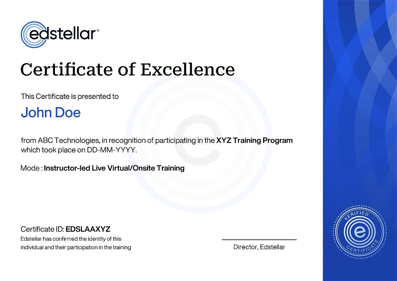
Get Your Team Members Recognized with Edstellar’s Course Certificate
Upon successful completion of the Spatial Analysis and Satellite Imagery in a GIS training course offered by Edstellar, employees receive a course completion certificate, symbolizing their dedication to ongoing learning and professional development.
This certificate validates the employee's acquired skills and is a powerful motivator, inspiring them to enhance their expertise further and contribute effectively to organizational success.

We have Expert Trainers to Meet Your Spatial Analysis and Satellite Imagery in a GIS Training Needs
The instructor-led training is conducted by certified trainers with extensive expertise in the field. Participants will benefit from the instructor's vast knowledge, gaining valuable insights and practical skills essential for success in Access practices.

.svg)
.svg)
.svg)

